
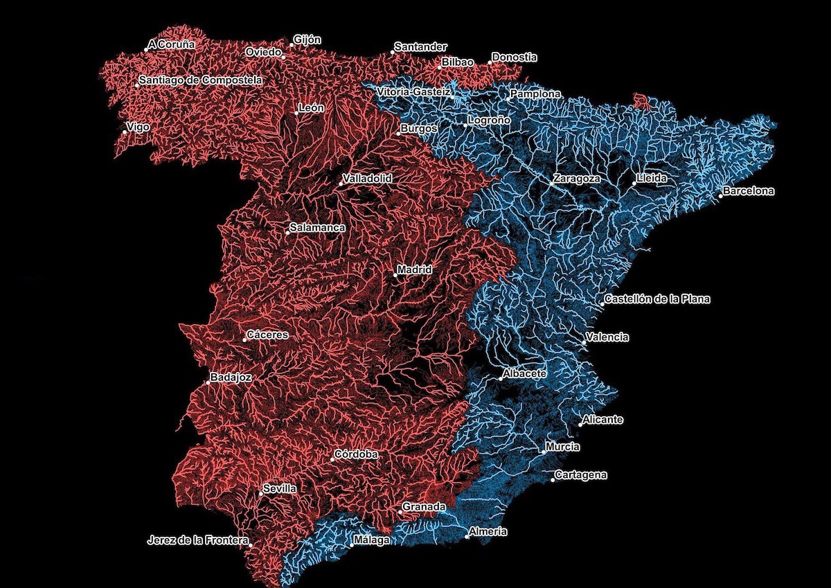
The Great Iberian Divide: the map that splits Spain in two through its two major river basins
TL;DR AI
2 min readKey summary
Joe Davies’ hydrographic map shows where rainfall in Spain ultimately drains, splitting the country between Atlantic and Mediterranean basins.
It uses examples such as the Ebro, the Segura, Galicia, Pamplona, and Madrid to show how geology and terrain shape river networks.
Features like the Pyrenees, the Iberian System, and the Central Plateau help determine which way water flows across the country.
The divide is important for understanding water management, agriculture, and land use in Spain.
Same topic